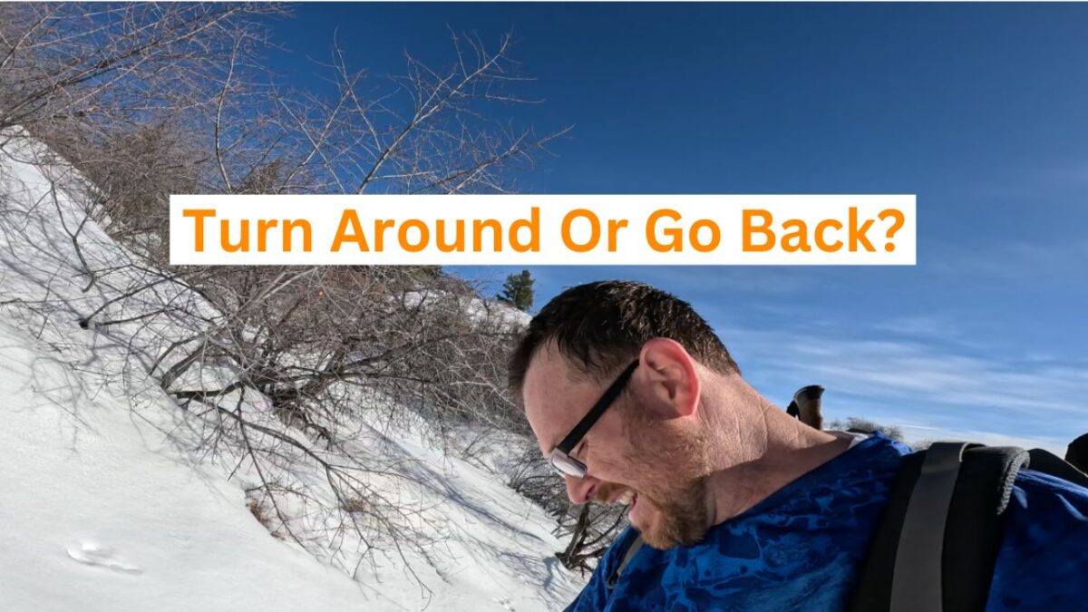
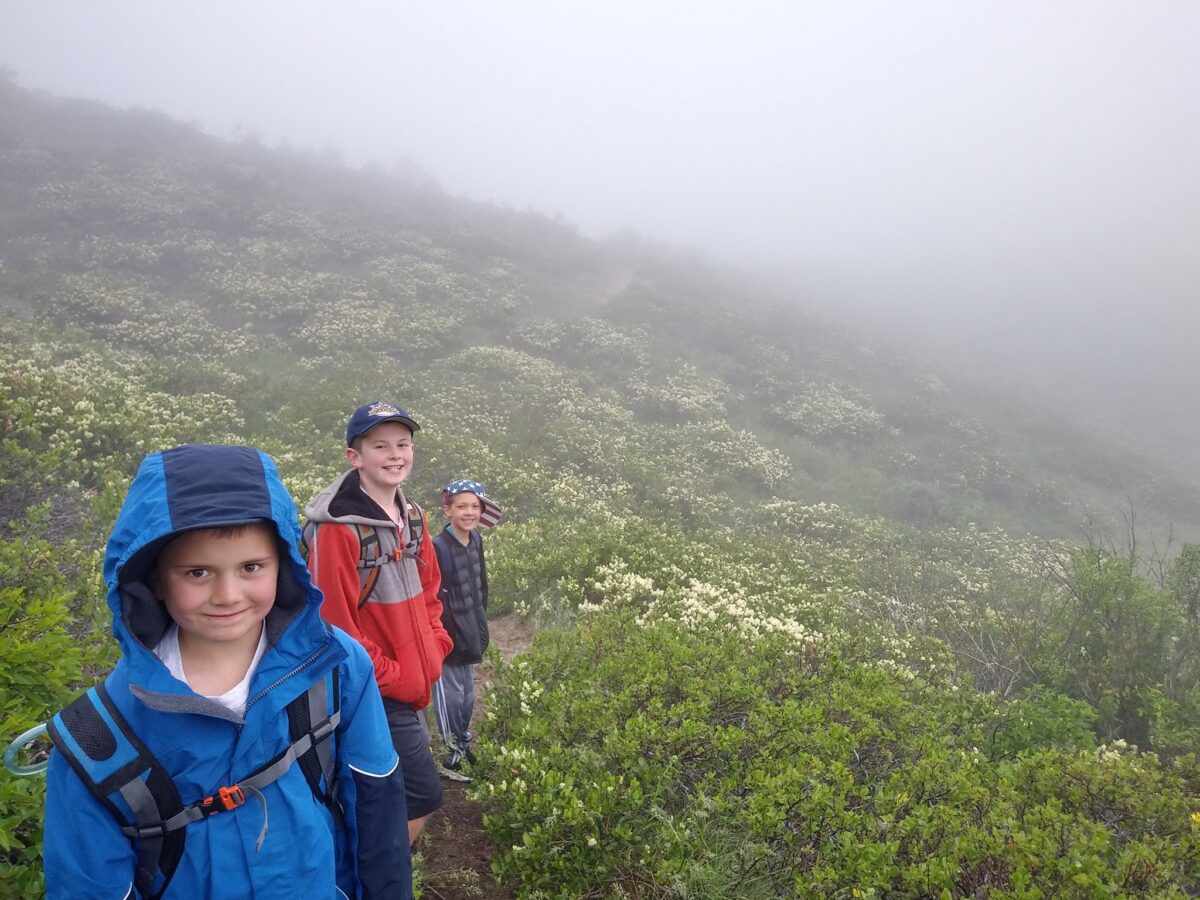
I was wanting to try a new route that I hadn’t done before heading up to Lucky Peak (Shaw Mountain).
However, this hike would take place in the winter time, when there was plenty of snow on the trail. I decided to leave behind my snowshoes for this hike.
The hike is approximately 8 miles and without snow there are several shortcuts you can take to cut it down. Sadly, I tried one shortcut and ended up in snow to my waist. I could have kept going but felt it was better to get back on the established trail.
Unfortunately, my bad luck didn’t end there as the weather began to turn and a trail I had been following ended up being a false summit. It was at that time that I felt it was safer to turn around, despite being so close to my goal.
The mountains will always be there to conquer another day.
You can check out our latest video, and if you haven’t already, please subscribe today and help us get to 1,000 subscribers!
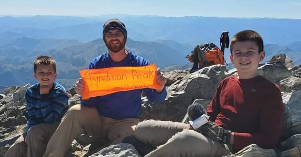
Idaho is where we reside, and Idaho is home to the “12er” challenge.
A 12er is a 12,000-foot mountain, and Idaho has nine 12ers in total. Hyndman Peak is the “smallest” 12er, coming in at 12,009 feet.
Hyndman is considered the easiest 12er in terms of how to get to the trailhead and how to get to the peak.
The trail itself is very defined, all the way until the base of the mountain. You can’t get lost on Hyndman and if you do it on a weekend during the summer climbing season, there will be plenty of other people around.
The first 2 1/2 miles of the trail are fairly flat. It’s a nice hike in the trees and runs several times near a creek. Some people take their bikes for these first few miles but understand that it’s not a “nice” trail. There are plenty of rocks, holes, and other things to look out for.
Once the first few miles are over, it’s a steep climb right away with a few flat areas here and there.
Toward the base of the mountain, there is a basin where a number of people will camp for the evening. There is plenty of flat area and sleeping the night before is easy to do.
We did not stay the night, and instead ate lunch at the basin and then headed to the saddle. Once you are at the saddle, head up to your left and up to the top. Some individuals will scramble up the scree before the saddle but we went to the saddle where there are more boulders to climb on, rather than dealing with the scree.
This was Bear Tooth, Little Wolf, and the cameraman’s first time on a 12er, and we weren’t sure how our bodies would react to the elevation. Camerman didn’t have any issues, but toward the top of the mountain, both Bear Tooth and Little Wolf started to get altitude sickness.
Despite the long hike to the top (about 7 miles), everyone made it safely!
However, once we were done at the top of the mountain, Bear Tooth and Little Wolf became more ill. Little Wolf began throwing up on the way down, followed by Bear Tooth.
Unfortunately, there isn’t a fast way down the mountain from the top. We went pretty slow, which took up precious time getting back to the vehicle.
Both the cameraman’s phone and our friend Tatyana’s phones died after we got down to the base of the mountain. We had no backup communication available.
For the last few miles of the hike, we did it in the dark. Thankfully, the trail is very defined and we had no issues getting back to our vehicle.
However, once we arrived at Tatyana’s van, the county sheriff showed up to greet us. Lol.
Apparently, family members had become concerned because of the lateness of our hike and they couldn’t get a hold of us. They had contacted authorities to go and search for us.
We spent a total of 14 hours of our day on the hike. It was long and by far the hardest hike we have ever done but we are proud of Bear Tooth and Little Wolf for this incredible accomplishment.
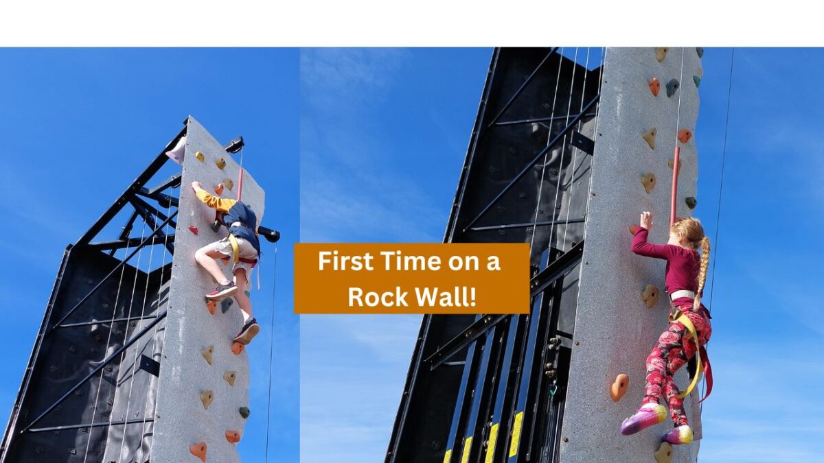
Pruett Hiking Adventures isn’t all about hiking and climbing in nature.
Sometimes we find ways to “climb” or hike closer to home. In this video, we share a little bit of the fun we had at the Wild Adventure Corn Maze in Idaho Falls, Idaho!
Nothing like a rock wall, zip line, and more to have a great day in the fall.
Years ago, a man named Tom Lopez created what is commonly referred to as the “Boise Grand Slam.”
Here is our preview video for the Boise Grand Slam:
Tom created the challenge to help get himself ready for bigger hikes later on in the year. These hikes are recommended to be done in the spring as the summer months in Idaho are brutally warm and can be very dangerous, given the lack of trees for the Grand Slam hikes.
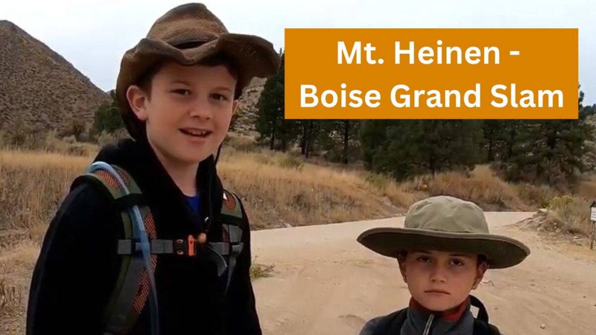
The fourth hike in the Boise Grand Slam is Mount Heinen.
Summit Height: 6,336 feet
Approximate Elevation Gain: 3,710 feet
Approximate Distance: Approximately 10 miles roundtrip
We recommend doing this last if you are doing the Grand Slam. The hike, especially in the beginning, is very steep.
This hike is not as popular as some of the others in the Grand Slam. There are probably several reasons for this.
It is much more challenging than the other three, although if you are in really good shape, you should be just fine.
Another reason that Mount Heinen may not be climbed as much is that the “trail” to get there isn’t very clear. At the beginning of the hike, the trail is very obvious. However, once you get higher up, the trail disappears, and you kind of just have to know how to get there.
We have only done this hike one time, and at the time of this writing, we would not feel comfortable guiding it. We had help on the last hike, and we got off track on the way back because so many of the ridges look the same.
Be sure you have a map or go with people who know where to go if you attempt this hike.
Warning: Be extremely careful if you attempt this hike during the summer months when the temperature gets really hot. It is not advised to do this hike in the summer. A woman died a few years ago from a heat stroke trying to attempt this mountain. Not only is shade hard to come by, but the strenuous hike is going to dehydrate you really fast.
How do you get to Mount Heinen?
This may be another reason the mountain is a little less climbed than the other mountains. Directions for getting there are harder to come by. Just like going to Cervidae Peak, you are going to turn right after the big bridge over Mores Creek. If you need to know for sure which direction to go, type in “Spring Shores Marina,” and that’ll get you on the right path.
Once you turn right onto FR-268 (the road to Spring Shores Marina/Cervidae Peak parking lot) you will go 14 miles.
Warning: The road will become gravel and VERY NARROW. The road completely drops off on one side, and there’s NOT room for 2 vehicles.
At about 14 miles in, you will find a small parking area on the right-hand side of the road next to Irish Creek Campground. You can type in “Mt. Heinen Trailhead” into Google and you should be able to use that to help find the trailhead.
How do you find the trail?
After you park, there is no obvious marking for where it starts exactly but you can cross the road and you will find the trail! See above for more directions.
Years ago, a man named Tom Lopez created what is commonly referred to as the “Boise Grand Slam.”
Here is our preview video for the Boise Grand Slam:
Tom created the challenge to help get himself ready for bigger hikes later on in the year. These hikes are recommended to be done in the spring as the summer months in Idaho are brutally warm and can be very dangerous, given the lack of trees for the Grand Slam hikes.
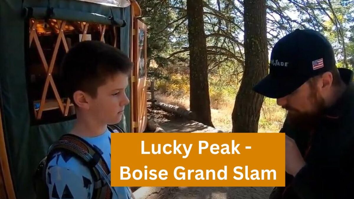
The third hike in the Boise Grand Slam is Shaw Mountain, more commonly referred to as Lucky Peak.
Summit Height: 5,904 feet
Approximate Elevation Gain: 3,032 feet
Approximate Distance: Approximately 11.4 miles roundtrip (Golden Dawn Route)
We recommend doing this hike third. If you are able to do Cervidae with its steepness and Kepros with its distance, Lucky Peak is a mixture of both.
Lucky Peak is a very popular hike, and you will be hard-pressed to find yourself alone on the mountain when there is no snow on it. Even in the snow, it is climbed often.
The Homestead route is very straightforward. We say straight, but Lucky Peak is a LOT of switchbacks. You’ll wonder at times if you are ever going to get to the top.
At one point, approximately a mile from the top, you’ll pass right below the peak as the switchback takes you around the backside of the mountain.
The backside of the mountain is awesome, though, after hiking for a long time. It provides some much-needed shade.
Depending on the time of year you go, you can also run into various organizations doing bird studies at the resting area near the top. Beartooth got to release a small bird one time when we were hiking in August. It was really cool!
How do you get to Lucky Peak?
Google “Council Springs Road” in Boise. There isn’t an exact “starting point,” so to speak. But you will park in a small dirt parking lot next to some houses. You’ll know the spot when you see it.
How do you find the trail, and how hard is the hike?
After you park, there is an obvious gate that you will walk around. You will go up Council Springs Road for approximately 3/4 of a mile. Then, you will see the trail off to the right. Just take that trail and you are off and hiking!
Important Note: Several miles into the hike, you will come to a “fork” in the road. Take the trail that goes to the left. You’ll first cross around a giant gate. Do NOT go to the right.
Years ago, a man named Tom Lopez created what is commonly referred to as the “Boise Grand Slam.”
Here is our preview video for the Boise Grand Slam:
Tom created the challenge to help get himself ready for bigger hikes later on in the year. These hikes are recommended to be done in the spring as the summer months in Idaho are brutally warm and can be very dangerous given the lack of trees for the Grand Slam hikes.
The second hike in the Boise Grand Slam is Kepros Mountain.
Summit Height: 5,428 feet
Approximate Elevation Gain: 1,988
Approximate Distance: Approximately 9.78 miles roundtrip (Southeast Ridge route)
We recommend doing this, hike second in the Grand Slam, although some argue that doing Cervidae Peak is easier. Kepros is 10 miles long, and if you have not hiked before, that distance could be troublesome for some.
While Kepros is a longer hike than Cervidae Peak, there is a lot of flat hiking which is a welcome break from the non-stop hills on Cervidae Peak.
Kepros can be more challenging if you decide NOT to take the bypasses.
There are a number of bypasses that skip giant hills. Depending on your conditioning and how hard you want to climb, you can take the bypasses or skip them. As of this writing, we have always taken the bypasses.
If you plan on doing this hike, be sure to know where you are going.
While Cervidae is very straightforward on where to go, Kepros could be a little trickier. With the bypasses, jeep road, and some other trails we have seen, it could be possible to get lost if you are not careful.
As far as dangers go, the biggest would be heat if you intend to hike it in the summer.
There is only one area on the entire route where the trail will come near trees/brush. It’s fairly deep into the hike and is the only place where you will find shade. Go early in the day if you intend to do this hike in the summer.
Second, there is no water along the way, so be sure to bring plenty.
Snakes and mountain lions are always a concern in many of Idaho’s mountains. We have never actually seen any snakes or mountain lions while hiking Kepros.
Finally, if you decide to hike Kepros in the winter, remember to be careful with what you wear during hunting season. There are deer that travel through this area, and hunting is allowed.
How do you get to Kepros Mountain?
Google “Kepros Mountain,” and you see Kepros Mountain Trailhead on the map. That will take you to a dirt parking lot area on the right side of Blacks Creek Road.
How do you find the trail and how hard is the hike?
After you park your vehicle, you are going to cross the road and you will see the trail very visibly when you do.
The first 1/2 mile of Kepros is fairly steep and will wake you up pretty quick. The following four miles are so are flat with some “up and down” mixed in. The final 1/2 mile is also pretty steep and has a to of loose rock right near the top.
When you climb the first part of Kepros, the trail will come to a “T” intersection. Go to the right and enjoy the hike. If you go to the left, you can climb 3-Point Mountain!
At the top of the trail is a “summit journal” where you can sign your name or whatever you would like to put in it.
Years ago, a man named Tom Lopez created what is commonly referred to as the “Boise Grand Slam.”
Here is our preview video for the Grand Slam:
Tom created the challenge to help get himself ready for bigger hikes later on in the year. These hikes are recommended to be done in the spring as the summer months in Idaho are brutally warm and can be very dangerous given the lack of trees for the Grand Slam hikes.
The first hike in the Boise Grand Slam is Cervidae Peak.
Summit Height: 4,987 feet
Elevation Gain: 2,054 feet
Distance: Approximately 2.25 miles one way (Southeast Ridge route)
We recommend doing this hike first in the Grand Slam, although some argue that doing Kepros is easier. However, Kepros is 10 miles long and if you have not hiked before, that distance could be troublesome for some.
Make no mistake though, Cervidae is no easy hike if you haven’t worked out in a while and even seasoned hikers are going to get a good workout on this one.
When hiking Cervidae, prepare to do a lot of uphill climbing. Depending on how you count them, you have approximately 12 hills, many of them very steep, before you get to the top.
Kids in our family as young as six-years-old have done this hike so you can do it. Also, one year, we saw an eight-month pregnant woman doing it!
If you plan on doing this hike, be sure to start doing some stair masters beforehand.
There are a number of things to watch out for on this hike.
First, be sure that you watch out for snakes depending on the time of the year you hike this. We have seen snakes out there, although both of them were bull snakes. There are rattlesnakes out there though so watch out.
Second, There is one bypass on the trail and it has a rather steep dropoff. Nothing anyone can’t handle but be sure to pay attention. Down below on part of the bypass are huge rocks that are going to stop your fall and it’ won’t be pretty.
In the wintertime, there is a small chance of cougars being in the area but unlikely.
Speaking of wintertime, if you decide to try this in snow, bring the proper equipment and enjoy the herds of deer that frequently move through the area.
How do you get to Cervidae Peak?
The easiest way to figure out how to get there is to go to Google and type in “Spring Shores Marina.” This will take you up to the Lucky Peak reservoir area. Once you get to Spring Shores Marina, continue approximately 1 mile past Spring Shores Marina. On the right-hand side of the road will be a dirt/gravel parking area. You’ll notice it immediately as it is rather large compared to the rest of the road.
How do you find the trail?
After you park your vehicle, you are going to cross the road toward the big metal gate. You can’t miss it. BE CAREFUL crossing the road because some cars come flying down the road.
Once you have either went under or around the metal gate the dirt path leads up and to the right. You will notice a barb wire fence on the left-hand side of you.
After less than 1/4 of a mile, you will see a big huge hole in the fence and the trail will be easily recognizable from there. The trail to the top of the Cervidae is very prevalent given its high usage. Even in the dark, it would be hard to get lost on this trail.
When you are just over half-way done with the hike, you’ll come to a small flat area. Go to the edge of this area and off to the right will be the trail that goes down a big hill and then back up again.
This is your final push to the top.
At the top of the trail is a “summit journal” where you can sign your name or whatever you would like to put in it.
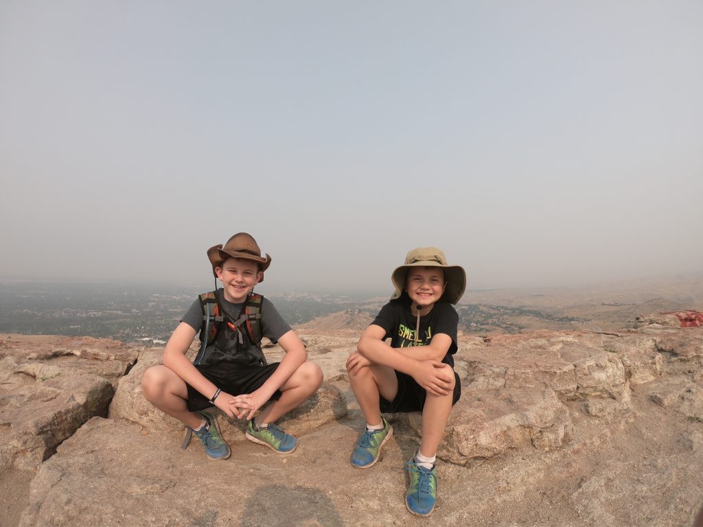
Table Rock was the first hike Little Wolf and I ever did. It looked really big! Our whole family ended up going on the hike which included our 3-year-old sister, 5-year-old brother, our mom, and of course our dad, the cameraman.
We weren’t sure how easy or hard the hike would be.
Table Rock is Boise’s most popular hiking destination so you can expect to see quite a few people on the trails. If you are looking for some quiet alone time, this is definitely not your spot.
You have to be on the lookout for snakes on this trail. Mountain lions have been spotted previously but are pretty rare.
The day we hiked Table Rock it was rather smokey.
The trail is 1.7 miles in one direction with about 800 feet in elevation gain if you are doing the Old Penn Trail.
With little kids, it took us a little longer than it normally would have.
However, the view at the top is incredible.
You get an awesome view of Boise and you can see the Owyhee mountains in the distance.
At the top of Table Rock is a really big cross. At night the cross is lit up with lights and you can see it from miles away.
You have to be careful at the top because there are some places where a fall is going to cause serious harm or death. So if you have little ones, keep them close by!
Overall, the hike is about 3.4 miles and is a good starter hike for anyone looking to get into hiking.
We want to welcome you to the official website of Pruett Hiking Adventures!
It is our honor to have you as a supporter of PHA and we look forward to having you with us on our journeys.
Bear Tooth and Little Wolf are the stars of the show and encourage all their supporters to get out and do more hiking. God has blessed us with tremendous natural beauty and more people need to enjoy it!
Be sure to follow us on all our social media platforms and become a member of Pruett Hiking Adventures today.